At a Glance
-
+7.4K
Features Field Verified
- Location
- Santa Cruz, California
- Offices
-
- Location
- Santa Cruz, California
- Offices
Share
University of Santa Cruz Utility GIS
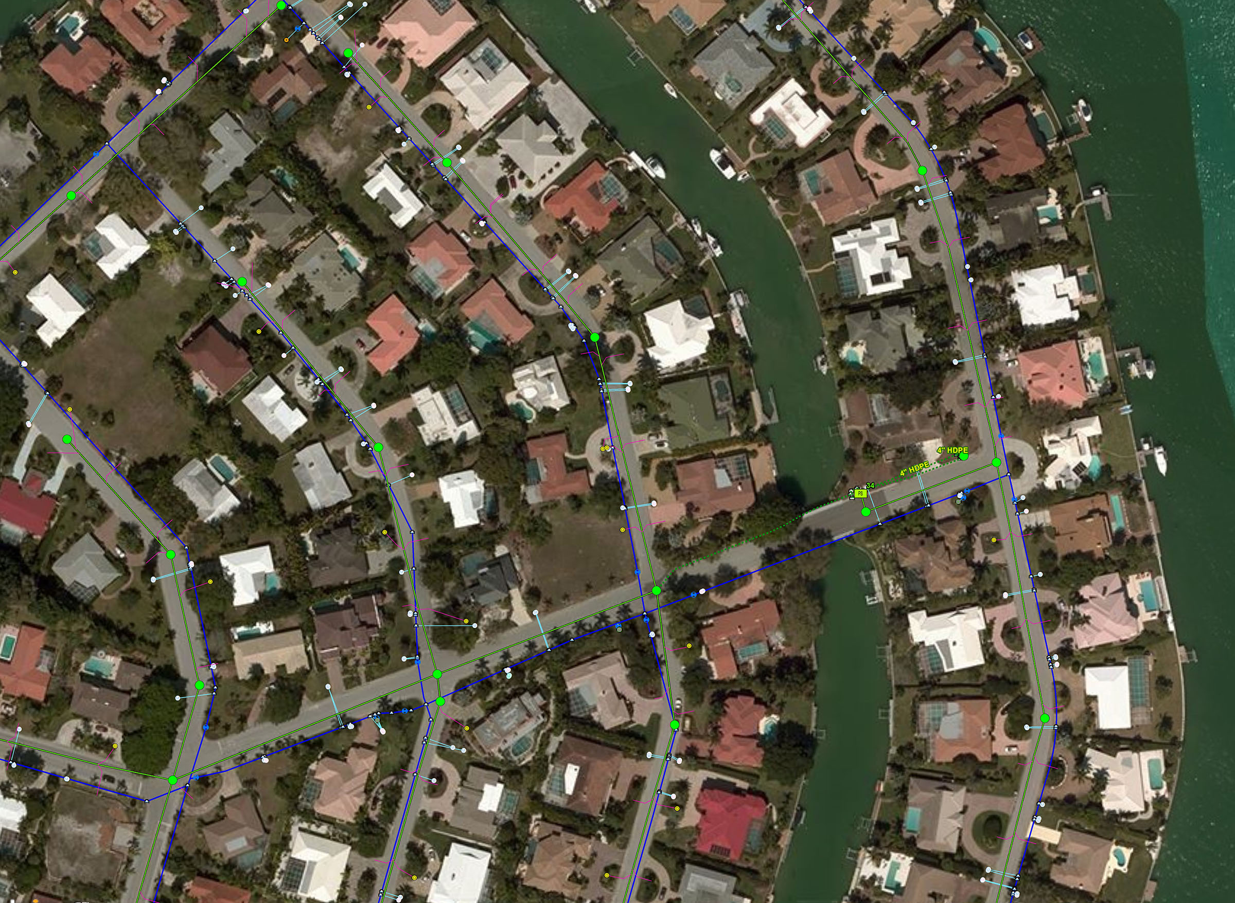
University campuses are responsible for the performance and maintenance of their infrastructure, and managing those assets requires tracking specific characteristics including location, condition, reoccurring maintenance problems, service requests, engineering plans, and photos. Geographic information systems (GIS) can manage this information through data set integration.
When the University of California Santa Cruz contracted us to develop a GIS for their utility infrastructure, we began the work of cataloguing their water, natural gas, electric, and telecommunications assets. We conducted stakeholder interviews, geodatabase design, and converted the existing AutoCAD drawings into a GIS format.
Using Esri’s ArcGIS Online and Collector for ArcGIS products, we sent field teams out with iPads and high-precision GPS receivers. Each asset’s location was verified, and the photos and attribute information were uploaded and reviewed back in the office by our GIS analysts.
Leveraging this technology allowed a distributed team from across many Stantec offices to collaborate on the project and share project status with the client. The result? A robust accounting of their utility assets had the University of California Santa Cruz ready to deal with any challenges those systems sent their way. As Parker Welch, spatial data coordinator for the University said, “I can’t imagine the utility mapping process going any smoother.”
At a Glance
-
+7.4K
Features Field Verified
- Location
- Santa Cruz, California
- Offices
-
- Location
- Santa Cruz, California
- Offices
Share
Matt Wagoner, Senior Principal, Geospatial Technology Leader
GIS allows us an opportunity to bring technology to each of our projects. It enables us to ask spatial questions and return a graphical result.
Jason Trook, Senior GIS Analyst
By displaying our data on a graphic or in a web map, users can get a more comprehensive understanding of how project components interact.
Tony Zavanelli, Principal, Energy
The best feedback is being awarded with additional work. ‘Good job’ is nice to hear, but being entrusted with another project the best way to know that you are valued.
We’re better together
-
Become a client
Partner with us today to change how tomorrow looks. You’re exactly what’s needed to help us make it happen in your community.
-
Design your career
Work with passionate people who are experts in their field. Our teams love what they do and are driven by how their work makes an impact on the communities they serve.


