How New Orleans’ response to Hurricane Katrina improved public safety and economic growth
August 19, 2021
August 19, 2021
After Katrina, New Orleans was forced to improve its risk reduction system, rebuild storm surge barriers, and more effectively manage drainage
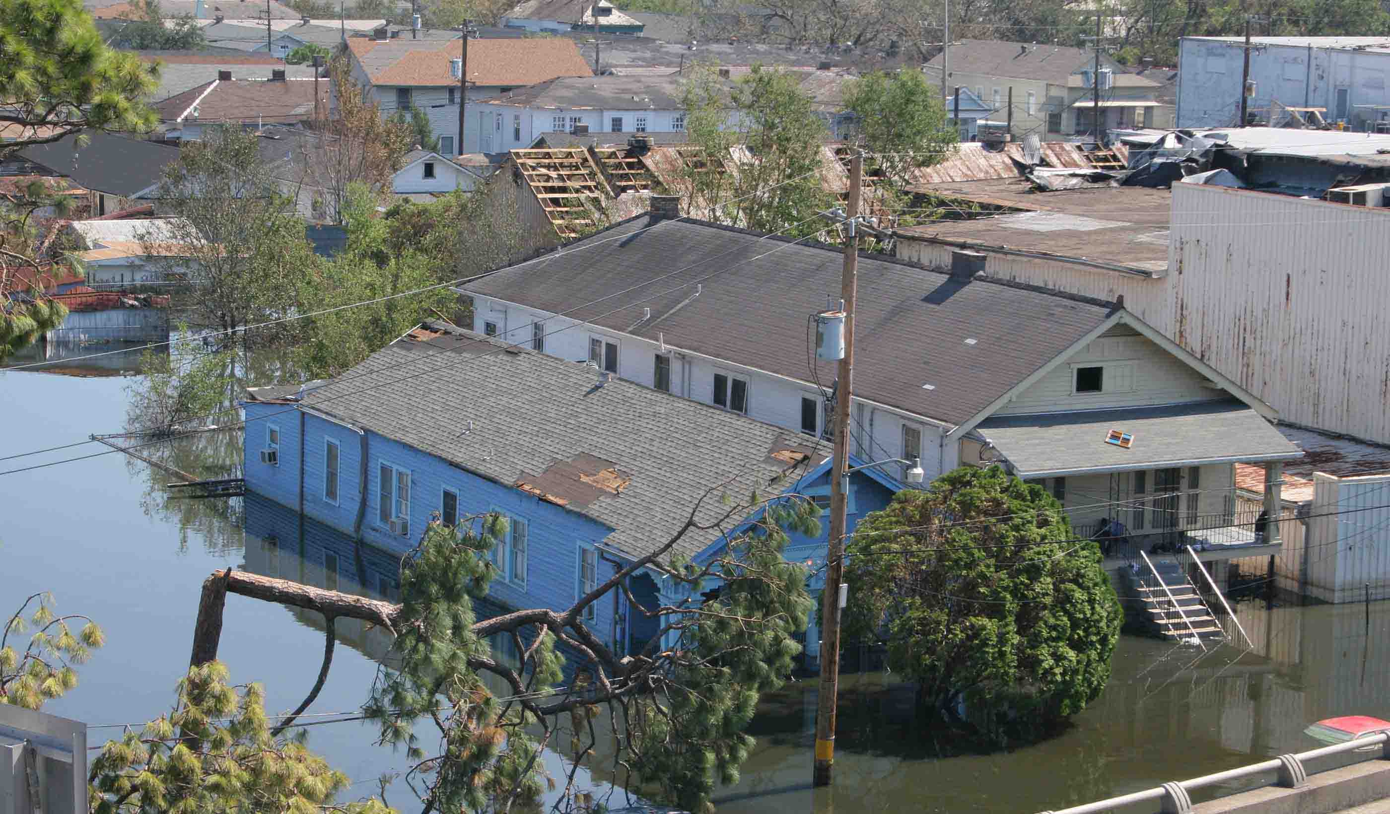
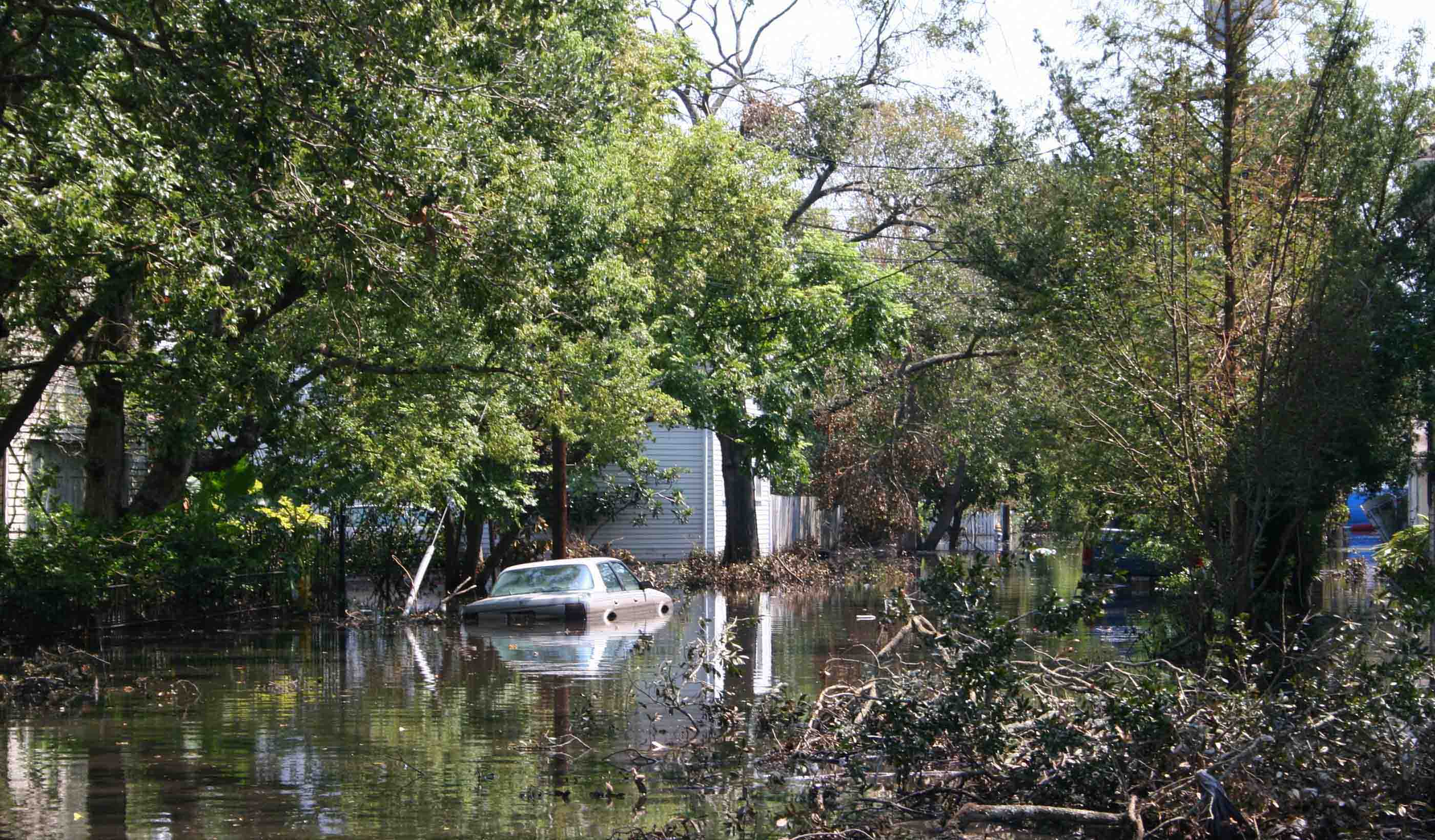
In 2005, my hometown of New Orleans was devastated by Hurricane Katrina, causing extreme damage and loss of nearly 2,000 lives. I lived in New Orleans before, during, and after Katrina and I have witnessed the major changes in response to that event. These changes were necessary for the survival of my home and the vitally important coastal community that it represents.
The Mississippi River is the reason the city is where it is, as the river connects the heartland of America to the Gulf of Mexico and foreign ports beyond. The river provides the maritime superhighway that transports grain produced in the Midwest to overseas shipping markets. Historically, the annual overflows of river were the source of the freshwater and sediments that built Louisiana’s coastal landscape and its enormously important seafood industry that depends on it. Lastly, onshore and offshore Louisiana is responsible for about 28% of our nation’s domestic oil and gas production.

The city of New Orleans is surrounded by water in a low-level elevation, making it more difficult to drain water levels.
When I was a kid, another powerful storm—Hurricane Betsy—slammed New Orleans. We thought that event was our “once in a lifetime” storm due to the amount of damage that was caused. So, when Hurricane Katrina was about to hit, we didn’t think it would be as bad. Katrina ended up being worse, causing $125 billion worth of property damage in addition to the tragic loss of life. In response to the devastation, federal, state, and local governments worked together to result in a comprehensive solution.
The federal government greatly improved and fortified structural protection around the city, including almost 350 miles of levees, flood walls, and numerous pump stations, while improving navigation structures. Given the topography of the city, with some areas as low as 10 feet below sea level, flood protection included both a levee around the city to protect it against storm surge and a network of connecting canals and pump stations that collected internal rainfall and pumped it to receiving areas outside the levee system.
When the original system was constructed 120 years ago, the footprint of the city was much smaller and flood water was discharged to adjacent swamps and marshes. As the population increased, those swamp and marshes were drained and used for residential and commercial developments. Unfortunately, the rainfall collection and discharge system were not appropriately ungraded to ensure adequate flood-risk reduction to those developed areas.
During Katrina, the water level of Lake Pontchartrain rose dramatically as did the levels in the long outfall canals that connected the 1900 vintage pump stations and their discharge to Lake Pontchartrain. The floodwalls along these three outfall canals were overtopped and the city slowly filled with water. One of the components of the new and improved storm damage risk reduction system was the Permanent Canal Closures and Pumps project. The project addressed the flaw in the original system and allowed continuous operation during storm events and did not allow lake water to enter the discharge canals. For these three new pumping stations, there are three main components. The first is a bypass channel, the second is pump stations to pump out excess water, and the third is a power generator in case of loss of power. Having this system in place provides a new level of protection against flooding in the area.
This type of transformation in the way we view water is fundamental to our sustainable future.
The State of Louisiana recognized the importance of its vast coastal landscape and the current and future loss of those wetlands through primarily subsidence and sea level rise. So, they developed a Comprehensive Coastal Master Plan to guide future restoration activities.
One of the major components of this plan is to reconnect the Mississippi River to adjacent wetlands that are deteriorating by constructing large sediment diversions. This includes the Mid-Breton Sediment Diversion on the east bank of the river south of New Orleans. Our team is currently designing this diversion to capture sediment in the Mississippi River and deliver it to the surrounding wetland areas. The diversion flows will be about 75,000 cubic feet per second and result in as much as 20,000 acres of new wetlands over the next of 20 years.
This is helping the city in a few different ways. First, it will reverse coastal land loss and help combat flooding by providing a storm surge barrier. By restoring deteriorating wetlands, this project will also provide a healthy ecosystem for the plants and animals that depend upon them. We also believe that these newly created wetlands could sequester approximately 24,000 tons of carbon each year.

Hurricane Katrina caused destruction to New Orleans in 2005. Nearly 2,000 people were killed about $125 billion worth of property was damaged.
Before Hurricane Katrina, we thought the only way to address rainfall was to pump it out. But Katrina clearly demonstrated that we needed to reconsider our relationship with water.
The Dutch and their “living with water” perspective has been embraced by the citizens of New Orleans. As a part of the Blue and Green Corridors project, we worked with the local community to design projects that both addressed floodwater issues but also resulted in more beautiful and liveable neighbourhoods. Residents suggested that bike friendly areas be added along with new parks that also served as flood storage areas during heavy rainfall events. The green infrastructure interventions were designed to reintroduce water to the ground. Benefits from this project will be reflected through flood reductions, healthier lifestyles, more beautiful neighbourhoods, and increased economic activity. The idea that we would have rain gardens and designated bike lanes was not something even contemplated prior to Katrina. This type of transformation in the way we view water is fundamental to our sustainable future.
Resiliency takes all of us—federal, state, and local governments—working together for our common prosperity. In my opinion, the City of New Orleans is a better place today than it was before Hurricane Katrina. We are a much more resilient city that will be better protected when it comes to future storms and heavy rainfall events.