Surveying Hawaii’s Kalaupapa Peninsula: Connecting a rich past to an exciting future
April 27, 2022
April 27, 2022
Using innovative technology to overcome the challenges of isolation and bring one of the world’s most beautiful locations into the 21st century
January 6, 2022, marked the 156th anniversary of the first placement of 12 patients suffering from leprosy, now known as Hansen’s disease, into forced isolation in the Kalawao settlement on the Kalaupapa Peninsula in Hawai‘i.
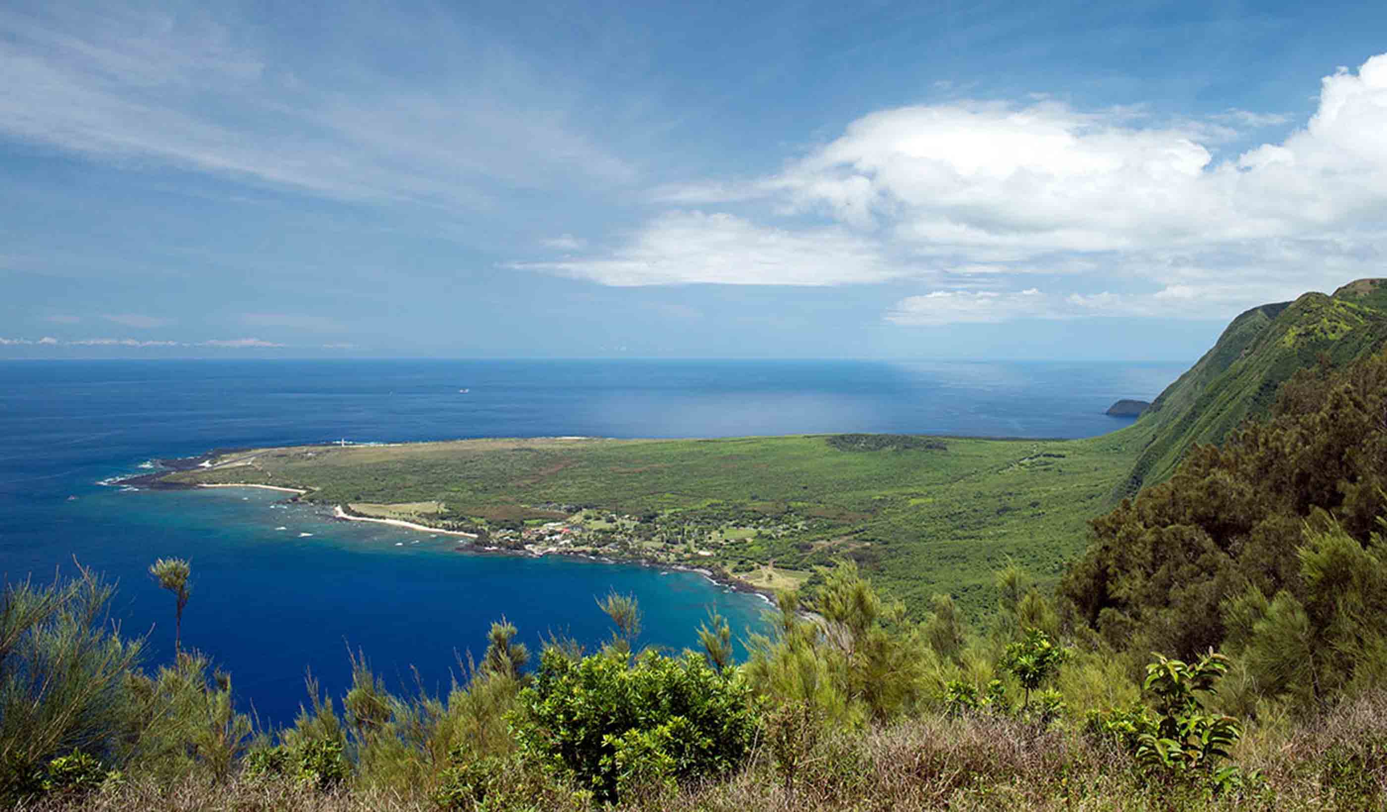
The Kalaupapa Peninsula on the island of Molokaʻi is home to the remote island-community of Kalaupapa. Kalaupapa became “home” for nearly 8,000 patients, until 1969 when a cure for Hansen’s disease was developed and distributed. When the quarantine was lifted, most patients left, but some stayed as Kalaupapa became their new way of life. Currently six patients live in Kalaupapa, along with a team of National Park Service (NPS) and Department of Health (DOH) staff.

The Kalaupapa Peninsula on Hawaii’s island of Molokaʻi can only be reached by small plane, a hiking trail, or a rough boat ride.
When our team was selected to conduct a topographic survey along three designated areas in the Kalaupapa National Historic Park, we knew the inherent challenges of the location and the innovative surveying techniques we would need to implement to make the project successful. What we didn’t know was the emotional impact the project would have on us and the immense pride we would feel in helping to shape Kalaupapa’s future while respecting its rich past.
The Kalaupapa Peninsula was created by an offshore shield volcano erupting millions of years ago. This caused a natural barrier to form between the ocean and 3,000-foot cliffs—some of the largest in the world—that were impossible to scale during the days of the settlement. This geographic layout essentially created a prison within an island, keeping the patients in and visitors out. Nowadays, Kalaupapa is only accessible by single-engine plane, an NPS installed hiking trail, or a rough boat ride. There is no way to drive into Kalaupapa.
Our team was selected by NPS to conduct a linear topographic survey along three designated roadways in the park that totaled 12 miles. The project’s intent was to help improve reliability, complete deferred maintenance, and improve operational maintenance for the area’s power grid update. The upgrades include new power poles and electrical lines throughout the settlement, and ultimately connecting the existing water treatment facility to the electrical distribution system. Due to mandatory historical site preservation regulations, one area of roadway would require a new underground distribution line. This brought an additional challenge to the overall project by requiring the engineers leave the site as-is and build the new distribution line entirely underground along the service road that connected the original Kalawao settlement to Kalaupapa.

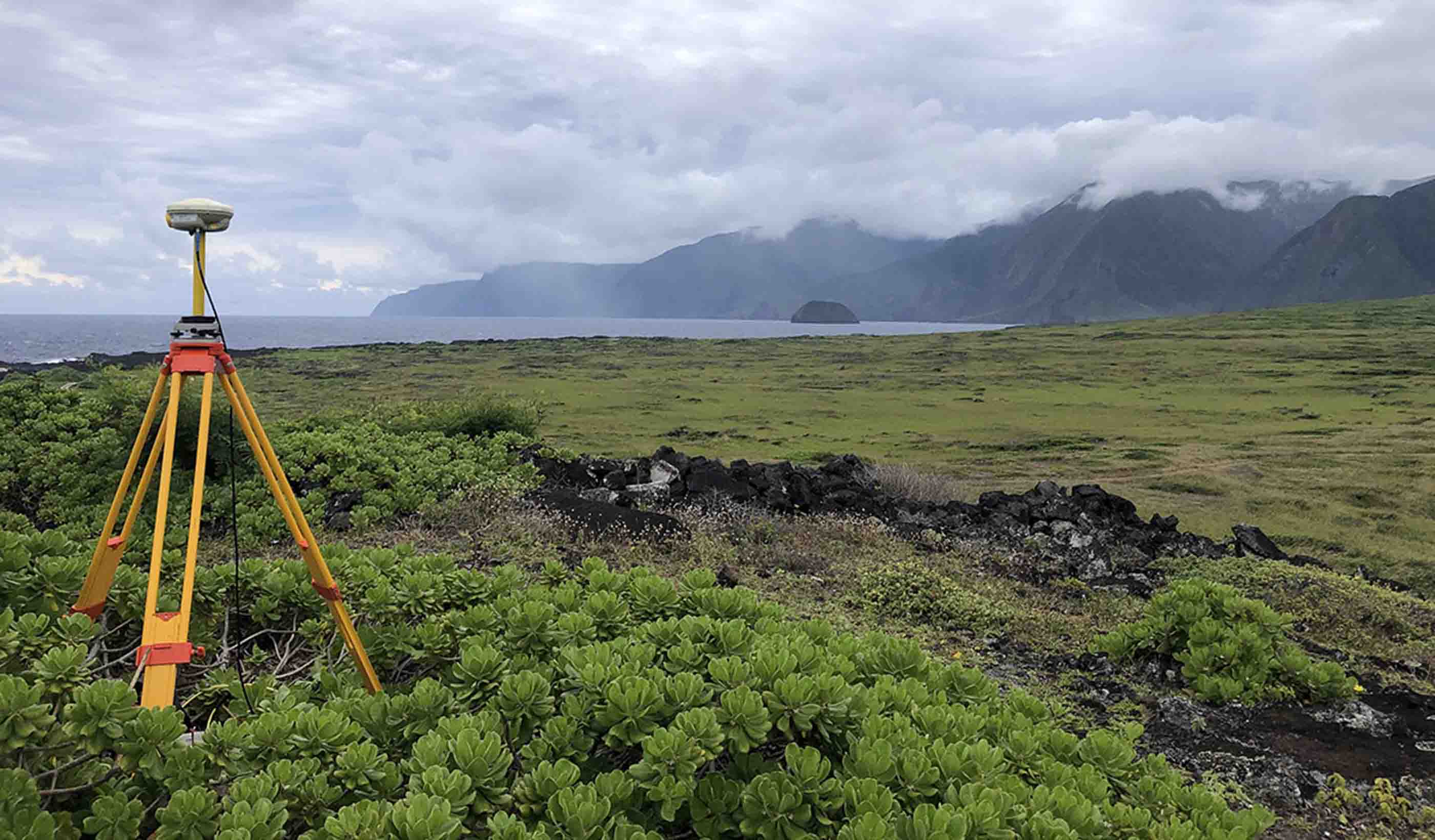
A combination of global navigation satellite system technology (to establish ties to Old Hawaiian State Plane) and terrestrial survey equipment (to accurately locate and document culturally sensitive relics and native plant species) were used on a sensitive project in Hawaii.
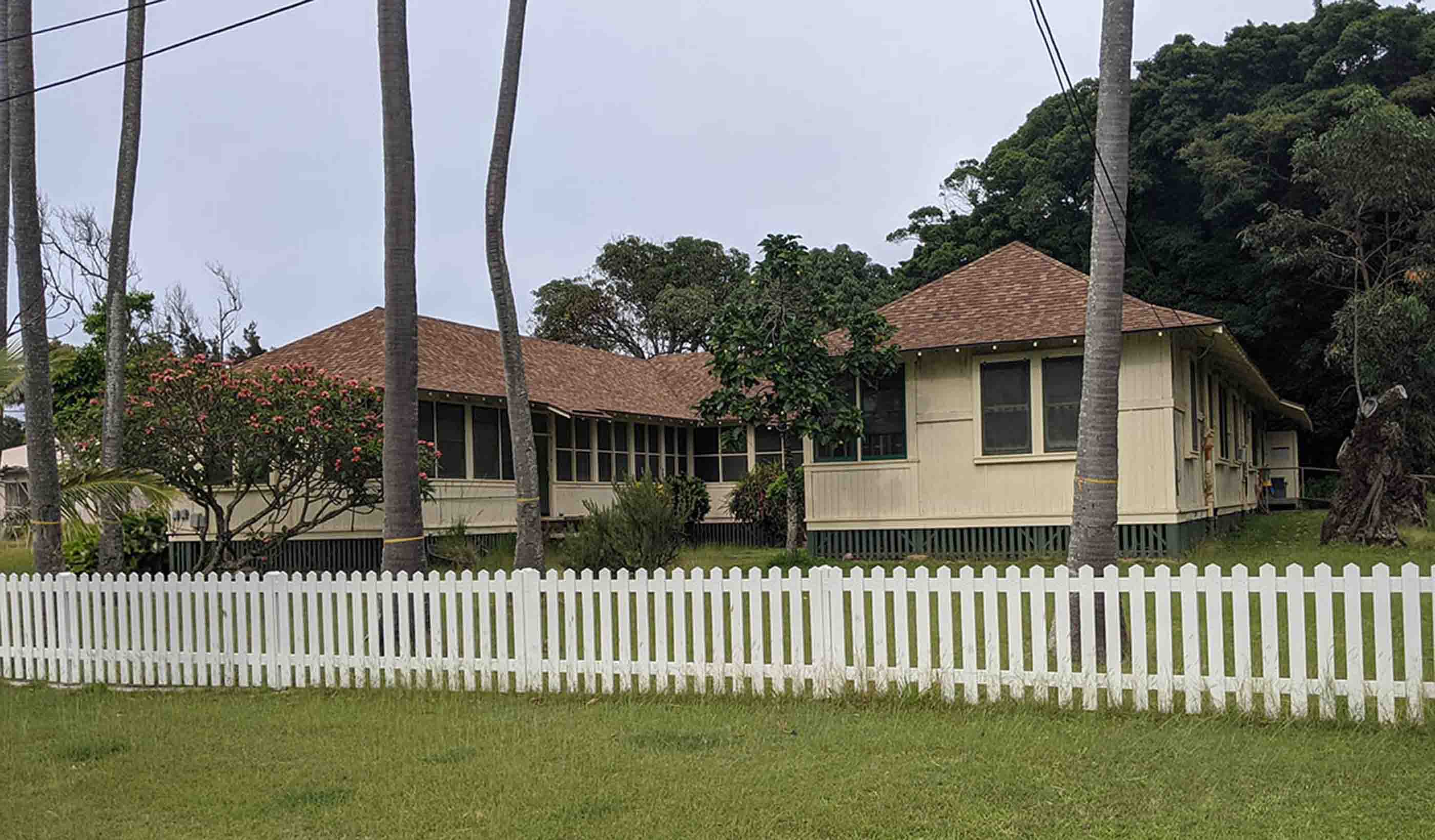
As mentioned, Kalaupapa was already an incredibly isolated location with limited access. The COVID-19 pandemic, however, added an extra layer of isolation. While on site, we needed to socially distance from Kalaupapa DOH staff and the remaining patients. During our first visit, after hours and after our full days of work, we were limited to only the “Nurses Quarters” where we had lodging during our stay.
It quickly became clear that we were going to have to get innovative to ensure success on this project. Do-overs were not an option.
With isolation often comes untouched beauty, and the Kalaupapa Peninsula is no exception. The park preserves an array of natural resources. Coral reefs, a crater with an 800-foot-deep lake, intact coastal salt-spray plant communities, high-elevation rain forest, and the steep forested Waikolu Valley contains a wide variety of aquatic, terrestrial, and marine habitats. In fact, nearly 30 federally listed threatened and endangered species of plants and animals have been identified within the park—some of which exist there and nowhere else on the planet. We even made multiple day trips to the rim of a volcano where ties to an original survey monument helped connect us to the Old Hawaiian State Plane coordinate system for the Peninsula.
So, how did we ensure a successful project without disturbing the stunning beauty around us? A combination of a global navigation satellite system to establish ties to Old Hawaiian State Plane and terrestrial survey equipment to accurately locate and document culturally sensitive relics and native plant species along the alignment, as well as the use of a “field-to-finish” workflow to ensure swift data collection and processing of roadway features. After all, the shorter your time traversing the grounds, the less likely you are to disrupt the natural environment. It’s that’s simple.

The Nurses Quarters at the Kalaupapa National Historic Park’s Kalawao settlement, where the nurses who cared for the Hansen's disease patients were housed during the 1930s.
We used a new Stantec Geomatics field code and attribute database to further accelerate the time needed to post process and reduce our survey data into a readable topographic survey map. That may sound complicated, but simply put, we developed a list of acronyms for key markers and features, as well as attributes about those features. By using our preconstructed feature code list, most of our field data was quickly read by our post-processing software that drew up point features, line work, the land contours, the break lines in the field, and the water lines—everything that goes into a roadway topographic survey. And we did all of this in a single software platform: Trimble Business Center. Diverting from past use of multiple software platforms to get our final map, we used one platform to sort everything.
It quickly became clear that we were going to have to get innovative to ensure success on this project. Do-overs were not an option.
Working in this beautiful and remote location, it was clear to us from the start that we were delivering this project for a greater purpose: Connecting a rich past with an exciting future. Because of that, we felt an immense responsibility to preserve this sacred land—not only for future visitors and residents, but for past inhabitants.
While we spent most of our time alone, we felt incredibly connected. To the land. To its people. To its past. And to its next 100 years.
As we said, we anticipated challenges. We didn’t expect a project that would have a profound impact on us and one we would feel tremendous pride in helping to deliver.