Your guide to resilient infrastructure planning and investments
March 03, 2020
March 03, 2020
A Resilient Infrastructure Investment Matrix helps analyze vulnerable areas by identifying and ranking their risk profiles
Cities in every part of the world are facing daunting challenges associated with climate change. Coastal areas are racing to prepare for sea level rise, increased intensity of storms, and related storm surges. Other areas are scorched by rising temperatures, drought, and wildfires. Here in the Midwest, we just completed the wettest decade in human history.
Many cities find themselves with stormwater drainage systems that are now undersized by 20% or more. As difficult as it is to meet the challenges this presents, the actual risks are far more difficult. The frequency of major weather events has increased. Even more damaging are slower-moving storms. Hurricane Harvey stalled over Houston in 2017 and dumped 30 inches of rain.
The $125 billion in storm damage that occurred in Houston is formidable. Sadly, Hurricane Harvey is just one of a steadily increasing number of global weather-related disasters. It isn’t reasonable to expect that any city is going to build infrastructure to handle 30 inches of rain. But it is clearly necessary to design and build infrastructure that sustains less damage and recovers more readily after major events.

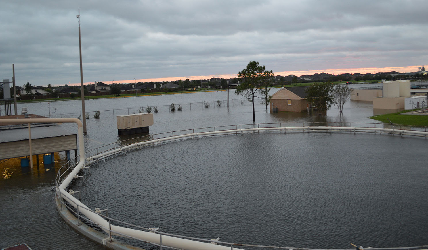
The Barry Rose Water Reclamation Facility during Hurricane Harvey. When Hurricane Harvey stalled over Houston, it dumped 30 inches of rain on the community.
The word resilience is broadly defined and used in many different contexts. In the area of municipal infrastructure, it measures the capacity of a system to absorb the impact of an event and its ability to adapt and recover better.
It is widely accepted that every $1 spent on resilience saves a minimum of $6 in recovery. Therefore, there is a compelling economic case to be made for proactive investments in resilient infrastructure.
Rather than being paralyzed by the random uncertainty of major disasters of any kind, this tool can support leaders in taking positive action to protect their communities.
Unfortunately, city leaders are confronted with compounding problems as they plan to respond to climate change. The availability of financing to build resilient infrastructure is limited. Often, basic infrastructure needs are underfunded and get priority. Frequently, the legal authority to finance public improvements demands uniformity and limits the funding mechanisms to invest strategically. Finally, the randomness and unpredictability of major weather events makes it impossible to prioritize any investment with certainty.
The process of developing and implementing a resilient infrastructure strategy starts with the acceptance of this uncertainty. While it is impossible to predict where and how the next major weather event will impact a city, it is possible to identify the areas of greatest vulnerability. Then we focus on those that pose the greatest risk to public safety, potential damage to public and private investment, the greatest recovery costs, and the greatest disruption of civic life.
This change in perspective allows political leaders to overcome the paralysis of uncertainty and make informed decisions, based on objective risk assessment. In the case of the City of Eagan, Minnesota, we utilized a GIS database to map low areas and existing stormwater drainage systems. This information was used to graphically illustrate the areas that would be inundated by 500-year interval rainfall events.
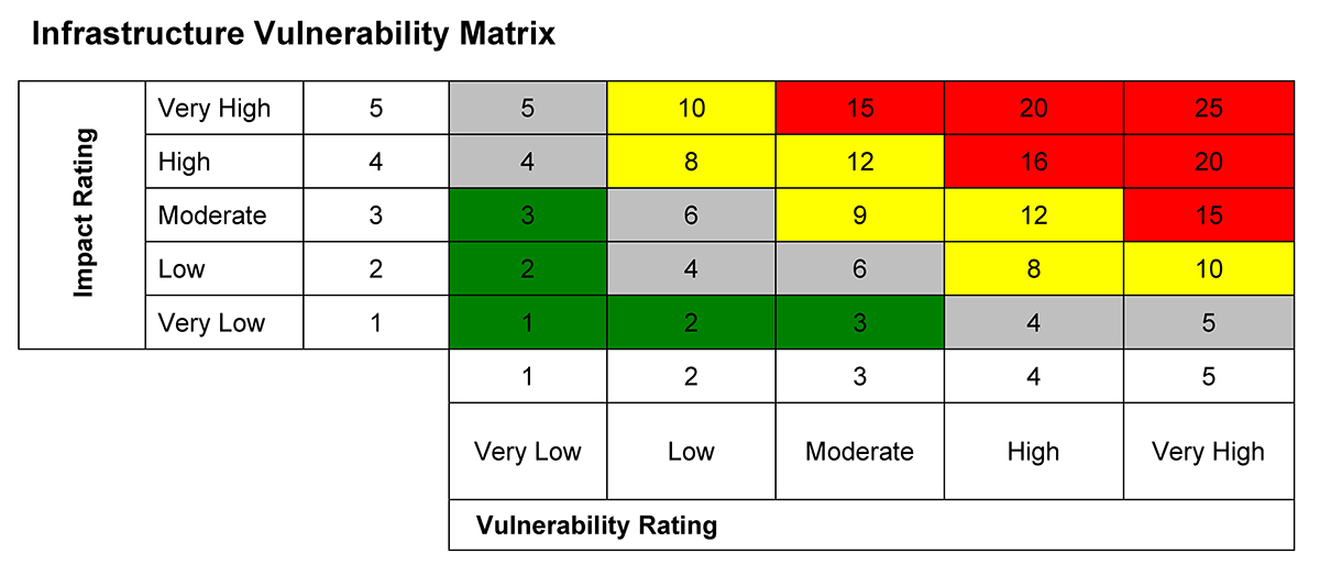
These flood-prone areas were then analyzed to identify and rank their respective vulnerability. Once that was determined, the relative risk to human life, private and public property, critical emergency response routes, roadways with the highest traffic volumes, as well as the infrastructure damage that would be the most disruptive were determined. The combination of these factors led to the Resilient Infrastructure Investment Matrix shown below.

The Resilient Infrastructure Investment Matrix helps analyze flood-prone areas by identifying and ranking their vulnerability and the areas that pose the greatest risk to public safety, potential damage to public and private investment, the greatest recovery costs, and the greatest disruption of civic life.
Every city will have its own unique vulnerability criteria and risk factors. But each city can adapt their own version of the Eagan matrix and create a decision-making tool to identify and prioritize investments in resilient infrastructure.
When assessing vulnerability, different parts of the country will prioritize different types of events. Coastal cities should be more concerned with high tide, sea level rise, and storm surge exposure. For others it will be extreme heat, wildfires, drought, or flooding. Likewise, the consequences of major events will vary based on the distinct characteristic of the area.

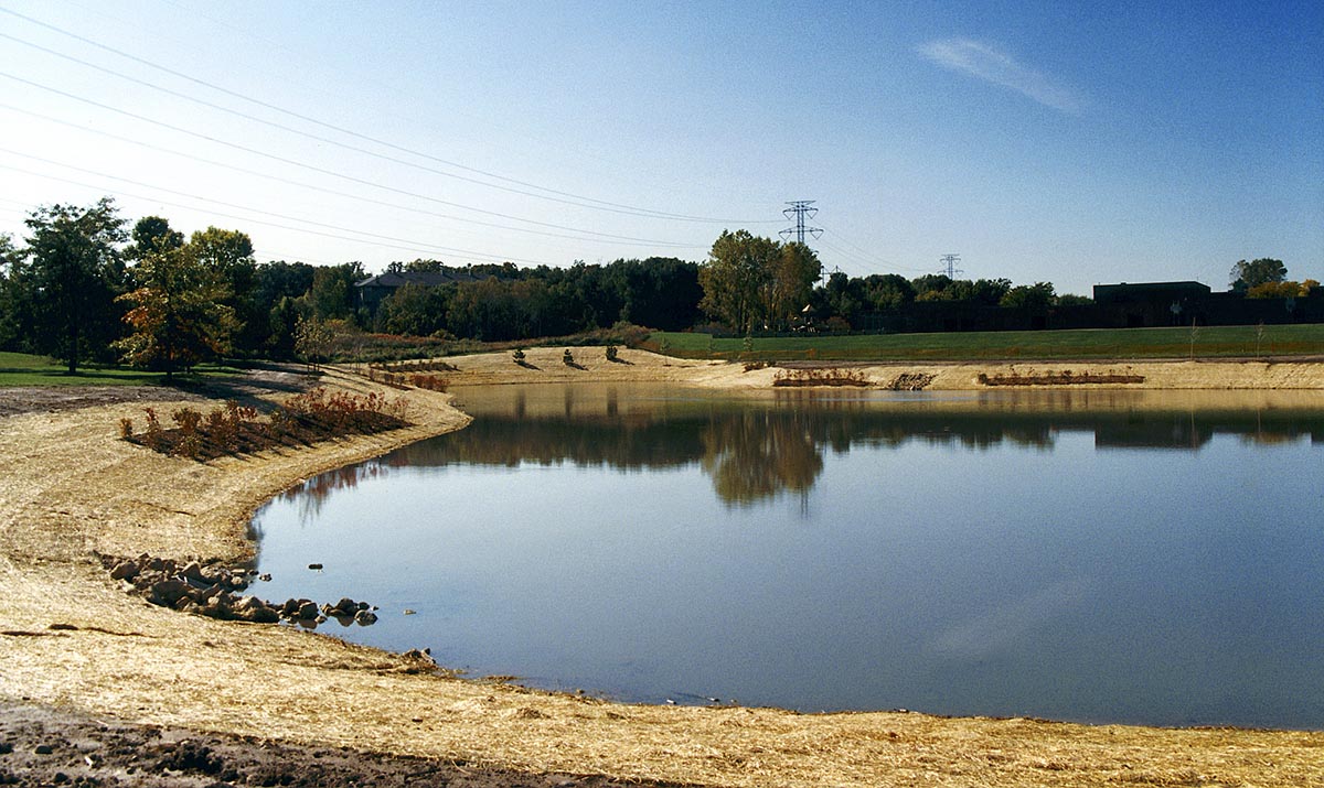
A storage water pond that was part of flood mitigation improvements in Eagan, Minnesota.
The hope is that leaders will replicate this thought process and adapt its approach to match their assessment of the relative vulnerability of areas within their communities.
This tool should never replace judgement when making investment decisions, but it does provide a rational basis for prioritizing investments in resilience. Rather than being paralyzed by the random uncertainty of major disasters of any kind, this tool can support leaders in taking positive action to protect their communities.