Putting geographic information systems data online to make city life easier
June 08, 2016
June 08, 2016
Web-based GIS applications are streamlining the way cities and counties operate
Water, water, everywhere - but not a drop to drink. A similar conundrum has plagued GIS for years. Volumes of useful data everywhere, but very little is accessible to those that need it most. GIS stands for geographic information systems. It’s a system that captures and stores spatial information. GIS products have historically been presented as paper maps or spreadsheets. But, what if this information could be presented differently—like in real time. What if clients, or even the public, could retrieve this information when they actually needed it. This got us thinking…
Utilities departments rely on GIS regularly, from managers making capital improvement plans, to maintenance and design staff referencing data about systems and what’s below the ground. GIS acts as the backbone of a municipality’s ability to serve its customers. So we know that various staff benefit from GIS, but how do we get the information to them?
Think about Google Earth for a second. Most people have heard of, and have used the Google Earth application. It provides real-time, accurate geographical information. So, we wondered, why couldn’t we create a Google Earth-like application (or app) that contains all the utility data for cities and counties? The good news is that after researching this idea, we knew we had the expertise to create a GIS-web based application. So, working with the City of Sarasota, that’s exactly what our team did.

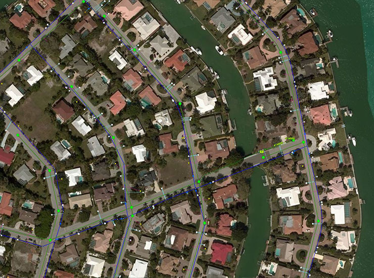
With the City of Sarasota’s help, we brought GIS data to the masses in an easy-to-use web app that allows the public to view, query, and analyze GIS data. They can even print their own high quality maps with ease. And, why would the public use GIS data? Well, here are some of the most commonly-asked questions:
What is my neighborhood zoned for?
Am I in a flood zone?
Where does my water come from, and then flow to?
How can a storm event affect me?
What school zone are we in?
When are my trash pickup days?
Thanks to our recently completed GIS system from Sarasota, the public can now answer all of these questions with a click or two of the mouse. Land developers can find out where the nearest water main is without having to call the utilities department and waiting a week to get the answer.
A contractor recently commented how amazing the new system is, and the city officials are just as pleased. Susan Blake, Infrastructure Information Coordinator with the City of Sarasota’s Utilities Department says, “Layers upon layers of information are available now. Just within the Utilities category you can locate the potable water, reclaimed water, and wastewater networks, manholes, laterals, lift stations, water meters, fountains, and a lot more. City of Sarasota crews working in the field with a mobile device will be able to retrieve information without having to return to the office. So, this will result in a more efficient use of time.”
A more efficient use of a municipal employee’s time, and a happier, more empowered community? Sounds like a win-win to me!