How to create a lead service line inventory through data
October 05, 2023
October 05, 2023
How can utilities deliver safe drinking water? Start by building a lead service line inventory.
The clock is ticking on the US EPA’s Lead and Copper Rule Revisions (LCRR) deadline to inventory public and private drinking water service lines. While the EPA hasn’t yet released regulations on replacing the lines, we expect them to come this fall in the likely Lead and Copper Rule Improvements regulation.
For now, water utilities need to get to work on completing a lead service line inventory. The deadline is October 16, 2024.
As we help utilities around the US navigate this requirement, we know that most of you won’t have all the data you wish you did. The good news is that you’re probably not starting from zero. Using existing tools and data can help speed the process—and when we pair our experience in water with our Stantec Altitude platform using machine learning and advanced analytics, your data can become even more valuable.
When we look at what’s required to get lead out of our water infrastructure to deliver safe drinking water, it can be daunting. It includes:

Copper pipes replace lead pipes as US water utilities move toward an October 2024 deadline to complete a lead service line inventory.
If your head isn’t spinning, you’re a step ahead. When it comes to lead service line replacement efforts, creating an inventory is the foundation. This is where you set yourself up for success. The goal of the inventory? Accurate, complete, and usable. It’s a living dataset that you can regularly update and improve over time—and provide safe drinking water.
Let’s look at how we create a lead service line inventory. With the collective knowledge we bring from many projects, we’ll cover everything from information gathering and tools to inspections, data collection, and funding.
The starting point will be different for every water utility. It all depends on the size of the system, availability and condition of historical records (and their level of detail), lead service line investigation methods of the water system, and methods required by the state. We’ve seen this firsthand in some of our LSL work with cities in Massachusetts including Norwood, Maynard, and Hamilton. As we prepare for other projects in Jackson, Mississippi, and the Toho Water Authority in Florida, we expect starting points will vary as well.
Having the right tools to make the most of the above information is one way to save on headaches. And there is a good chance most utilities already have it!
If a water utility or department already has a digital copy of its pipes, meters, hydrants, and service lines in a geographic information system (GIS), they’re most likely using products from Esri. It is the industry leader in products to maintain a GIS that is a spatially explicit, living inventory of public utility assets. And we use them, too.
When it comes to lead service line replacement efforts, creating an inventory is the foundation.
With Esri’s ArcGIS Online (AGOL) platform, we can access a solution for lead service lines that fits the way we deliver those services. This solution is easily integrated into most utilities’ existing GIS. The platform design aligns perfectly with the US EPA’s service line inventory template—and we can adjust it to meet state templates as well.
For some water utilities, a GIS may not yet exist. Many utilities, especially smaller ones with fewer administrative staff, have legacy paper records that need to be digitized. For example, they may have a daunting row of filing cabinets in the basement containing historical tap cards. Or maybe there is just a single box, but the information is handwritten. Working with several clients of different sizes, we’ve seen it all.
The best plan? Transforming paper records into a tidy spreadsheet and uploading it to AGOL. This automatically backs up precious historical data on the cloud. Backing up good paper records is useful, and machine learning methods can quickly label tap cards by service address to make information searchable and easier to organize.
As an Esri business partner, we have access to all these tools. Pairing this with our Stantec Altitude™ platform taps into advanced data analytics, machine learning, and digital twins to unlock the power of data—maximizing your existing investment. We layer on our analytics to turn data into decision-making information. In this case, service line material prediction and replacement project prioritization are just two applications that will enhance and advance a public water system’s lead service line program.
We like to consider your GIS inventory as part of the “system of record.” Stantec’s interfaces and analytics are the “system of action” on that data. This will ease future efforts to update and maintain an accurate inventory; it helps with regulatory compliance and stakeholder communications.
We start working off a single point of truth, like pipe materials from historical tap cards or maintenance records. Our team fills in the gaps—centralizing thousands of data points into something everyone (from top to bottom) can securely access.
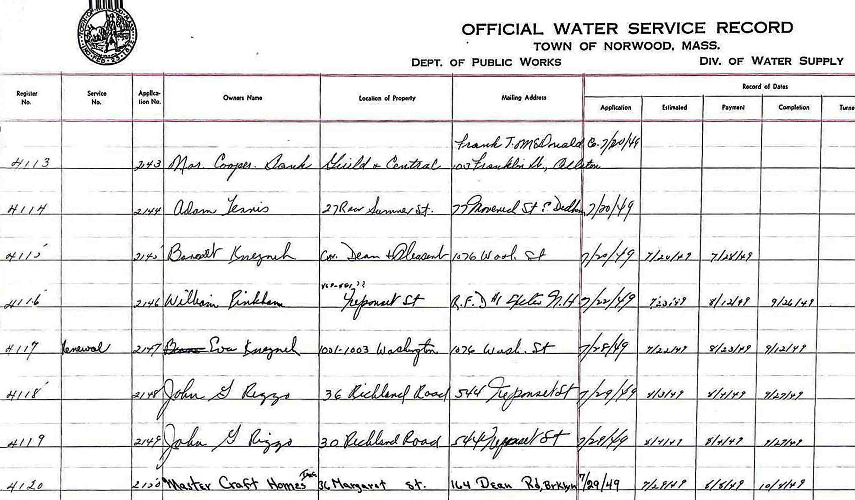
For instance, in a small New England town in the US, we helped prepare a material inventory of nearly 10,000 water service lines. Once we determined that the water service cards alone could not provide the level of detail needed, our team worked with the town’s public works department to unearth more key documents. Some dated back to the late 1800s!

Old water service record from Norwood, Massachusetts.
Water service installation ledgers, service repair and replacement reports, and assessor’s information helped round out our needs. The ability to cross-reference multiple sources and transfer information from old record books to electronic databases was essential. It helped us take the first steps in creating an initial lead service line inventory.
With a baseline inventory, we move towards the assessment phase. Here, we address data gaps while also identifying materials for those pipes that were categorized as “unknown.” We also field verify pipe materials that are logged in the inventory database. Field verification is important to check the accuracy of historical records, which can be 40 percent to 60 percent wrong.
Additional data to supplement, enhance, and improve the inventory can come from a variety of sources. These may include::
From Hawaii to Maine (and even over to the United Kingdom), we also use a variety of visual inspection methods to support our data collection. These include the use of mechanical excavations, hydrovac excavations (or potholing), and visual inspections at water meter boxes. All these data sources feed into the program. They verify unknowns and are key to building a solid and reliable digital inventory of water assets.
Our work on these programs is a win-win. How so? Not only are we helping solve the environmental challenge of clearing lead out of our water infrastructure, but each water utility will have a digital twin of its system. Digital twins serve as the bridge between the physical and digital domains. Built on historical and real-time data, as well as machine learning models, they provide a virtual representation of physical objects, processes, and systems.
The end geodatabase of service lines and their material makeup are easily exported. They meet both state and the EPA’s data requirements of the Lead and Copper Rule Revisions (LCRR).

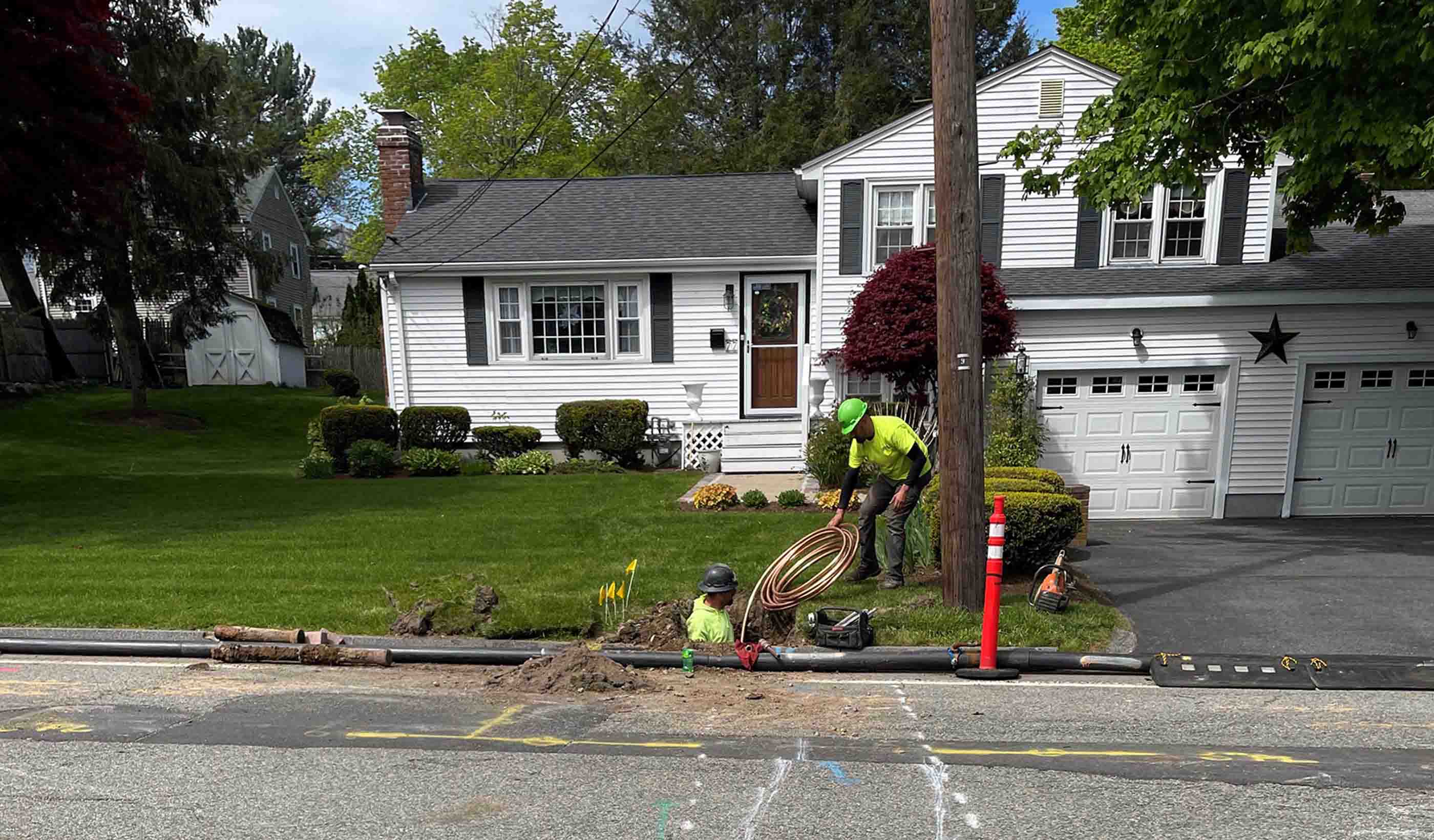
Pipeline replacement in Norwood, Massachusetts.
The 2021 Bipartisan Infrastructure Law contains a historic $15 billion in funding to identify and replace lead service lines. There is an additional $11.7 billion in supplemental funding. This money is accessed through Drinking Water State Revolving Funds. These funds are limited and most applications have specific deadlines. So, it’s crucial for public water systems to apply for new funding programs, grants, and federal and state procedures as soon as they can.
The bonus? You don’t have to do it alone. We have been supporting communities in their efforts to remove lead from their drinking water systems for decades. With the enactment of the LCRR requirements in 2021, we are now actively engaged in the preparation of lead service line inventories, replacement plans, and how to fund it all for water utilities across the US.
The inventory phase is more than just the first step. When done right, it creates great value as the basis for an intelligent, dynamic, and highly scalable approach to get the lead out in an ongoing multiyear program. And that, we all hope, means safe drinking water.